Energy
.
Engineering, Design, GIS & Asset Data

Utility GIS Technician

Also posted as GIS Technician; Electric Utility GIS Technician; Gas Utility GIS Technician; Utility Mapping Technician; GIS and Asset Management Technician; Facilities Mapping Technician

Median wage range
$50k–$90k
National median · per year
Outlook
Growing
Entry barrier
Certificate
Certificate pathway, no degree
Overview

What is a Utility GIS Technician

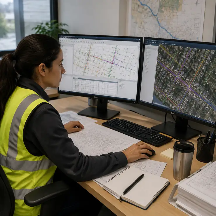
A utility GIS technician creates, edits, validates, and publishes spatial records for electric and gas utility assets so field crews, designers, operators, planners, and emergency teams can rely on accurate network maps. Most people start with a technical certificate or equivalent hands-on training rather than a four-year degree.

Utility GIS Technician
Role Snapshot

The role profile

Everything you need to know about this role, the same details employers use to post openings and colleges use to build training.

Median wage range
$50k–$90k
Typical annual pay based on national and industry data.
O*NET codes
15-1299.0217-3031.00
Primary and secondary occupational codes mapping this role to national labor data.
Cluster type
Engineering, Design, GIS & Asset Data
The broader industry group this role belongs to within the technician economy.
Context tags
Where and how this role is commonly applied.
Core skills
Enterprise GIS EditingNetwork ConnectivityAs-Built Posting
Essential competencies to perform this role effectively.
Canonical Role ID
UNMUDL-UT-A013
A unique identifier linking this role across training, jobs, and employer systems.
Pay & Outlook

How much does it pay?

Utility GIS Technician in this role earns a median of $50k–$90k a year. Here's how pay typically grows with experience.

$50k–$90k
National median annual wage range. Utility pay follows local schedules and bargaining agreements, and journey-level technicians with overtime and callout earn at the higher end.
Wage ranges are illustrative, based on national and industry data. Actual pay varies by employer, location, certification, and experience.
Entry
Experienced
Specialized
On The Job

What does a Utility GIS Technician do?

Explore the core responsibilities of this role, from daily operations and equipment handling to safety, quality, and performance requirements.

01

Maintain GIS records

Create and update GIS features, attributes, connectivity, equipment records, and network maps.

02

Post as-builts

Post work orders, as-built drawings, permits, service changes, and field corrections into enterprise GIS.

03

Collect field data

Collect and verify field locations using GPS or GNSS equipment.

04

Research source records

Research engineering drawings, construction records, easements, and customer information.

Skills You Will Build

What skills do you need?

Three core skills sit at the heart of this role. You can learn all of them through short, hands-on training.

Enterprise GIS Editing

Editing and managing enterprise GIS data for utility assets.

Network Connectivity

Maintaining utility network connectivity and asset attribution.

As-Built Posting

Posting as-builts and work orders into the system of record.

Your next step

How to become one.

Take a short, hands-on course to build the core skills, then apply to jobs hiring near you, all in one place, powered by the Unmudl Skills-to-Jobs® Network.

↗ Powered by Unmudl

Get job-ready
training

Short, hands-on courses and Skill Paths aligned to what employers actually hire for — built with colleges and industry.

↗ Powered by Unmudl

Find jobs
hiring near you

Connect with employers hiring for technician roles at every level. Browse live openings on the Unmudl job board.

Keep Exploring

Related roles.

back To Full Library
Common Questions

Utility GIS Technician, FAQ

A utility GIS technician creates, edits, validates, and publishes spatial records for electric and gas utility assets so field crews, designers, operators, planners, and emergency teams can rely on accurate network maps.
The national range runs about $50,000–$90,000 per year, with a median near $70,000. Entry-level roles start toward the bottom of that range, and pay varies by employer, region, shift, and certifications.
Most people start with a technical certificate or equivalent hands-on training. You can build the core skills, Enterprise GIS Editing, Network Connectivity, and As-Built Posting, through training on Unmudl, then apply to open roles.
No. A technical certificate plus hands-on experience is the common route, and employers weigh demonstrated skill and required qualifications more heavily than a degree.
It's a durable technical career with a clear path to higher pay through experience and qualification. Growing demand is driven by utility network digitization, outage management, and asset management. The skills also transfer to related roles like surveying technician and civil engineering technologist/technician.

Ready to start your
technician journey?

Get matched with training, apprenticeships, and employers tailored to this role.